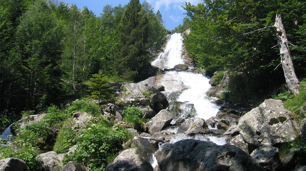
Peak Climb Tuc dera Montjòia
Tuc dera Montjoia
Technical data
 Diffficulty: Difficult
 Distance: 7 km
 Time: 6h
 Elevation: 950m
Description
Access to this peak along the Valley known as the Artiga de Lin. Be sure to observe the shepherd’s cabins along the route in the mountain. From the peak one will enjoy the spectacular views of the French Pyrenees.
Montcorbison Peak Climb
Montcorbisson
Technical data
 Diffficulty: Difficult
 Distance: 6 km
 Time: 4h
 Elevation: 600m
Description
Located in the heart of the Val d’Aran we will arrive to the base of the this peak through the lush Baricauba forest. As we go further along the route we are sure to enjoy the confers of the area. Once at the peak we will certainly be marvelled by the majesty of the panoramic view of the Val d’Aran only seen from this viewpoint.
Peak Climb Tuc de Mauberme
Tuc de Maubèrme
Technical data
 Diffficulty: Difficult
 Distance: 10 km
 Time: 6h
 Elevation: 900m
Description
Ascend along the Unòla River with its precious red color due to the area’s mineral resources and the old mines. The access to the peak can be done along the Montoliu Lake (lago) and from its peak one can enjoy the fantastic views of the Liat Lakes and France.
Hike and Ascent del Pòrt de Vielha
Tuc deth Pòrt de Vielha
Technical data
 Diffficulty: Difficult
 Distance: 11 km
 Time: 6h
 Elevation: 1000m
Description
We will begin the excursion from the Mountain Cabin (Refugio) of the “Espitau de Vielha” on the southern side of the Vielha tunnel. During the excursion we will be able to observe old military bunkers built during the Civil War. The communication challenges the people had with this area before the tunnel was built will become quite apparent along the journey.
Peak Climb of the Gran Tuc de Colomers
Gran Tuc de Colomèrs
Technical data
 Diffficulty: Difficult
 Distance: 14 km
 Time: 7h
 Elevation: 1000m
Description
This difficult ascent allows the hiker to enjoy the most lake ladden area in Europe. It is quite easy to find snow during any season of the year in which you decide to climb. This route takes us into the area of the Aigüestortes and Sant Lake Maurici National Park.
Montarto Peak Climb
Montardo
Technical data
 Diffficulty: Difficult
 Distance: 8 km
 Time: 5h
 Elevation: 850m
Description
The Montarto is probably the most recognized mountain in the Val d’Aran. Its 2833 meters offer a perfect lookout point of all of the area. From the peak the hiker can see many of the other mountains of the region. The Montarto is located in the most northern part of the Aigüestortes National Park and at the south of the Val d’Aran.
Via Calda
Via Calda
Technical data
 Diffficulty: Difficult
 Type: Hiking
 Distance: 88 km
 Accumulated Elevation: 4445m
Description
VIA CALDA is the perfect combination of trekking and thermal spas, staying in unique hotels with a package of services that include, amongst others, the transport of luggage at each stage. It is designed such that you can do it in 4 or 5 stages, joining the first and second together.
IMAGE: Visit the Aigüestortes National Park, Visit the circo de Colomers in the Val d’Aran with its 48 lakes, visit the Roman churches of the Vall de Boi declared a World Heritage site, Discover the culture and heritage of the Val d’Aran , its language and the remains of the old Roman road; Cross the Pyrenees on foot through the Port de Caldes (2,550 m), an ancient pass used by the Aranese and Ribagorzans for goods and livestock; Stay at the modern seaside resort of Caldes de Boi and many more surprises.
Tour del Aneto
Tour del Aneto
Technical data
 Diffficulty: Moderate
 Type: Hiking
 Distance: 115 km
 Accumulated Elevation: 11332m
Description
TOUR DEL ANETO, a circular self-guided trekking route that passes through the heart of the Pyrenees crossing the Posets-Maladeta Natural Park. Walk through 5 valleys: Val d’Aran, Valle de Luchon, Benasque, Castanesa and Barravés. Pass through 6 mountain passes: Còth de l’infern at 2,397m, Còth dera Monjoia at 2,065m, Puerto de Benasque at 2,444m, Collada de Basibè at 2,280m, Collado de Salinas at 2,177m and Port de Vielha at 2,442m with a total of 115 km and a total elevation gain of 11,332 m. Included in the package of services is the transportation of luggage at all stages. You only have to carry a backpack by day and at the end of each stage, you will find your luggage at the Hotel.


