Route Ribera de Aiguamòg

Route: Salardú – Presa d’Aiguamog – Banhs de Tredos – Salardú- Opcional Ribera de Valarties ( 4×4)-Arties
Difficulty: Medium
Type: Tourism

Description:

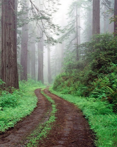
The Baños de Tredòs are located halfway along the valley. The soft relief in this sector of the valley makes for unforgettable strolls amid pine groves and marshland. The sulphurous waters of the valley of Aiguamog, produced by the thermal characteristics of the mountains of High and Low Arán, are used by the inhabitants of the Arán valley for bathing and healing purposes. These old baths were recovered in 1988. This spot guarantees peace and quiet at an altitude of 1500 m. The so-called cirque of Colomèrs, located at the head of the valley, is peppered with no fewer than one hundred lakes, the main lake district in Arán. The surrounding peaks almost top 3000 m, and the magnificent granite landscape affords the valley of Aiguamòg a virtually unsurpassable beauty. The asphalted track starts in the village of Salardú, and runs for about 8 km. The tail of the Aiguamog reservoir has a family picnic area with lush vegetation along the shore, with beech and red pine trees, and where lighting fires is permitted. It is pleasant in spring, summer and autumn. The track leads to the Tredòs Baths. You will have to leave the car here and press on, either on foot or in a seven-seater taxi which covers the route as far as the forest track goes, to the Colomers lakes. Following the track (4×4 only) takes you to the end of the valley, where there is a sharp bend followed by a hill up to the Collado de Pruedo. From here you can either go back down the way you came or continue to the banks of the Valarties, which leads to the village of Arties.

Route Còth Deth Portilhon-Còth de Baretja

Route: Bòssost-Còth de Portilhon-Mirador- Còth de Baretja
Difficulty: Medium
Type: Tourism

Description:

The climb to the Portilhon, up the asphalted road which leads to France, will make you feel the power of nature in its plenitude. The beech trees quickly make way for a very thick forest of centennial fir trees, often untouched by the rays of the sun. At the entrance to Bossost is the junction that leads to the Mountain Pass of El Portilhon. There is a picnic area with tables at the highest point. Just before the summit there is a turn-off on the left that leads into a fantastic forest of fir trees and on up to the vantage point of Còth de Baretja. This vantage point commands a marvellous view of the whole Valley of Luchon and Low Arán, as far as Es Bòrdes, Vilamós, El Collde Varradòs

Route Molières-Conangles

Route: Vielha-Tunel de Vielha-Hospital de Vielha- Conangles
Difficulty: media
Type: Turismo

Description:

The only Aranese valley whose waters reach the Noguera Ribagorçana River. Its easy access makes the Molières Peak, 3010 m, one of the peaks most frequently visited by the mountaineers. An obligatory stroll through the magnificent beech tree forest along the bank fo the Noguera Ribagorçana. The refugio (mountain hostel) called the Hospital de Vielha, also known as the Sant Nicolau deth Pontelhs, is located at the southern side of the tunnel and is the last inhabited location before crossing the Vielha Pass. At this point one will also find the Santa Quiteria Chapel where every 22 of May the area residents make a popular pilgrimage. 2.5 km from the southern exit of the Vielha Tunnel on the N-230 highway we will find large picnic area called Conangles. It is located at the head of the Noguera Ribagorçana and offers a number of facilities: tables, grills, etc. This area is the starting point for a number of excursions of great interest including the periphery of the protected Aigüestortes and Sant Maurici Lake National Park.

Route Bausen

Recorrido: Bausen
Dificultad: media
Tipo: Turismo

Descripción:

Es juntamente con el de Torán el valle situado más al norte de Arán. La sierra de Bacarena cierra el valle y limita con la frontera francesa. El ascenso al pueblo de Bausen nos permitirá visitar unos parajes que aún conservan características del pasado y donde se nota poco la huella turística. Desde él obtendremos una buena panorámica de Era Lana de Les así como del pueblo de Canejan.

Ruta Bosque de Baricauba

Route: Vielha – Gausac – Bassa d’Oles – Pla Batallé – Aubert
Difficulty: Medium
Type: Tourism

Description:

The Baricauba forest is one of the true marvels of the Arán Valley. It is a sprawling fir tree forest, very thick in some parts. The Bassa d’Ules is a small reservoir which is transformed into an idyllic mountain lake in rainy springs and summers. There is also an Environmental Education centre there which accepts groups of school children. The point of departure for this outing is the village of Gausac, a mere kilometre away from Vielha. When you reach Gausac take the asphalted track that leads up to the Montcorbison forest: Baricauba. There is a crossroads three kilometres further on where you turn left to go to the Bassa d’Oles, also known as La Piusa. This asphalted track is five kilometres long, and the direction to follow is clearly indicated. The picnic area of the Mair of Diu des Nhèus is just four kilometres after the crossroads, before you reach the reservoir. It is located in a meadow which is somewhat sparse in trees, although it does offer a great view of the Gèles gulley and the River Garona. Take the right-hand way to Pla Batallé, another family area which is well equipped for picnics. The beech and fir trees scattered over the spot provide some shade for the tables. Suitable in summer, the area has a barbecue, fifteen tables and drinking water. You can also reach this point from the village of Aubèrt by following the asphalted track from there until it forks. Bear left to reach the leisure area, about 450 m further on.

Ruta Bassa d'Arres

Route: Vilamòs – Arres de Sos – Bassa d’Arres
Difficulty: low
Type: 4×4

Description:

It can be reached by the Vilamòs-Arres de Sus local road. Once you reach Arres, continue along a dirt track for 2.5 km, approximately, until you reach the Bassa d’Arres. The recreational area is next to the reservoir.

Ruta Bassa d'Arres-Ribera de Margalida

Recorrido: Pònt d’Arròs-Vilamós-Arres de Sus- (Bassa d’Arres)- Bossòst
Dificultad: media
Tipo: 4×4

Descripción:

Desde Pont d’Arròs, situado a 5 Km. de Vielha en dirección Francia por la N-230, sale la carretera que sube al pueblo de Vilamós ( 6 Km.) ( 1255 m.). Vilamòs se alza majestuosamente sobre la Vall de l’Artiga de Lin y el gran bosque de l’Entecada. Se trata del pueblo más antguo de Aran. Desde aquí podemos hacer la ascensión al Montlude (2.517m). Aquí también encontramos el Museo Etnogràfico de Joanchiquet (LINK Museu de Joanchiquet). Siguiendo la carretera llegamos hasta el pueblo de Arres de Sus (1.267 m.). De este punto salen dos pistas, una de 3 Km. que llega hasta la Bassa d’Arres y otra que baja hasta el pueblo de Bossòst, pasando por un cruce que lleva hasta la Mina Margalida.

Ruta Montcorbau. Mair de Diu des desamparats

Route: Montcorbau
Difficulty: media
Type: 4×4

Description:

Points of interest. MAIR DE DIU DES DESAMPARATS. Sunny area surrounded by red pines and with great views above the Garona River. Apt during the spring, summer and autumn. Passing Vielha in the direction of Bossost take the local road LV-5052 that leads to Vilac. Leave the village behind until arriving to Montcorbau and once there take the road the heads out of the end of the village. The area is found following this dirt road about 2 km from Montcorbau.

Route Montgarri

Route: Baqueira 1500 -Pla de Beret (1.840 m) – Montgarri- Santuari de Montgarri (1.645 m)
Difficulty: Medium
Type: 4×4

Description

At an altitude of 1655 m, Montgarri was, until the seventies, the highest inhabited village of Arán, at the head of the Noguera Pallaresa, which rises in Pla de Beret, at an altitude of 1840 m. This is a veritable solitary beauty spot, very close to the sanctuary of Montgarri, where the procession of Nuestra Señora de Montgarri is held every July 2. The village of Montgarri used to be cut off from the rest of the Valley of Arán between the end of autumn until May or June. This is definitely one of the most classic and typical excursions of the Valley of Arán. Making your way along the bottom of the valley, you will come across stunning high mountain scenery where pasture meadows alternate with lush fir and black pine forests. El Pla de Beret is a stunning plateau that stands at an altitude of almost two thousand metres, practically the only one of such spread at this height in the Pyrenees. Two major rivers rise in el Pla de Beret: the Noguera Pallaresa, on the way to Montgarri and el Pallars Sobirá, on the southern side of the Pyrenees. The other one is the Garona, whose source is in the so-called Güell de Garona, very close to the former. The rivers split on this plain, where the Garona flows towards the Atlantic and the Noguera Pallaresa towards the Mediterranean. Near the sanctuary (perfectly restored) the rectory has been restored and now serves as the lodging for hikers. In addition, a bit up the mountain the visitor will find another old farm house now converted into another restaurant.

Ruta Portet. La casa de los ingenieros

Route: Les
Difficulty: Medium
Type: 4×4

Description:

Point of interest: ERA CASA DES ENGINHÈRS (the engineers house). An area for passing by with small dimensions and with minimum facilities in a fir tree forest. From the village of Les take the trail that goes along the side of the football field and is only paved along the first part. Follow the trail about 6 km until reaching the second turn. Take the trail to right. A few meters later you will find the recreational area. reativa.