Salardú-Unha-Gessa

Salardú | Unha | Gessa

Technical data

Diffficulty: Easy

Type: Lineal

Distance: 3,4 km

Time: 1h 5′

Elevation: 30-50m

Description

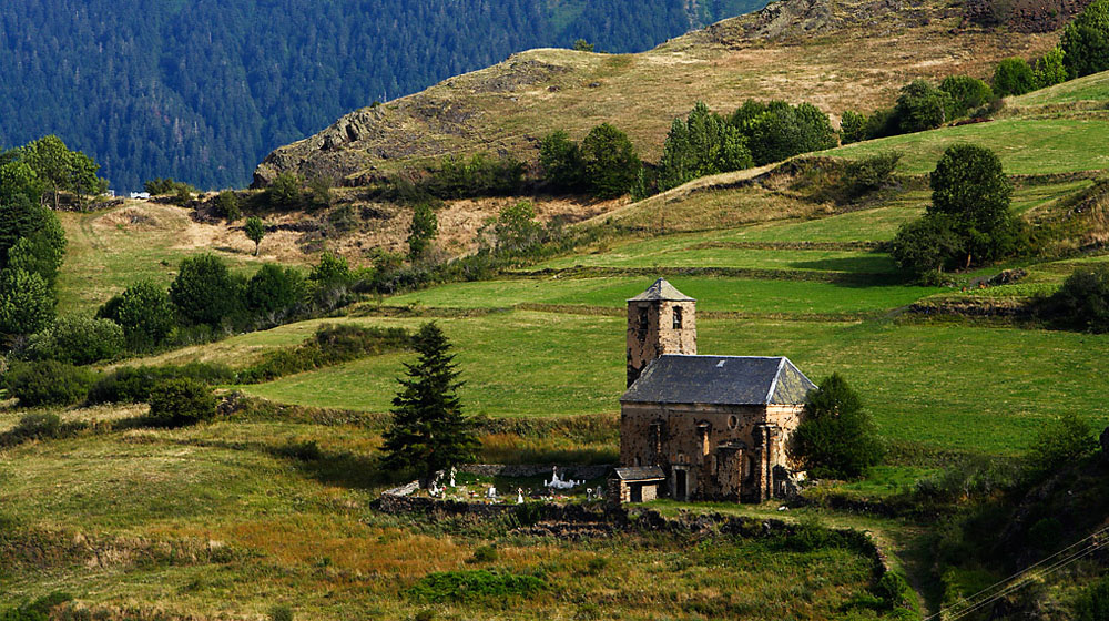
From the parking lot of Salardu take the road to Unha. At the entrance of the village we can contemplate the Ço de Brastet, a magnificent stately home from the 16th century. It is recommended to go up to the splendid Romanesque church of Santa Eulària (12th century) which holds a very interesting sequence of mural paintings which ranges from Romanesque paintings of the apse (12th century) to diverse compositions of Gothic and Renaissance styles of the walls of the nave (15th and 16th centuries). In some of the months of the year it can be visited in the Romanesque Route of Aran or with reservation. We can also visit the Museum of the Snow (Nhèu) located in the stately Renaissance home.

Once again we’ll take the GR211 trail which later crosses the village and takes us to the higher part of Gessa. We’ll descend on its streets until reaching the Sant Peir church square. The Ço de Ròsa stately home is worth mentioning with its impressive tower, an example of the civil architecture from the 16th and 17th centuries.

From there we will descend to the C28 road and shall continue with caution along the side. After crossing the Unhòla River we’ll take the first street to the left which we’ll take up until reaching the town squear where a pretty fortress and a Renaissance style home can be seen. Along a steep street we’ll reach the area of the Romanesque church, Sant Andreu, of Salardu. Originally surrounded by an important castle of which the principal tower is the current bell tower of the church. Inside the Christ of Salardu (12th) is worth observing as it is one of the most beautiful examples of Romanesque imagery. The Renaissance mural paintings are also worth mentioning.

Recomendations:

The churches of Unha and Salardu

Vilamòs

Vilamòs

Technical data

Diffficulty: Easy

Type: Lineal

Distance: 2,4 km

Time: 1h

Elevation: 50m

Description

Vilamos is worth special attention. According to tradition it is one of the oldest villages of the valley. The Santa Maria church is a Romanesque building (11th-12th centuries) which incorporates within its walls a great number of Roman elements (4th to 5th centuries A.D.). It was renovated in the 16th and 17th centuries.

Continuing along the main street we’ll arrive to the house of the Museum Ço de Joanchiquet. It is an interesting visit that shows us the traditional lifestyle up to the second third of the 20th century in the Val d’Aran. A visit to the washbasin found to the side of the museum is well worth it.

We can stroll through the streets of the village always with incredible views of the surrounding forests and beautiful mountains. We will continue once again towards the parking lot taking the trail that goes up to the left towards the cementary and the Romanesque chapel of Sant Miquèu (11th – 12th century) – 15 min. From here the views of the Maladeta range with the Aneto peak (3404 m, the highest of the Pyrenees) are excellent.

We’ll descend along the trail that goes down below the chapel until reaching the forest road. On the other side there are picnic tables and a grill. It has a fantastic viewpoint. Turn to the right and after crossing the tubes of the hydroelectric center we’ll reach the parking.

From the other side of the parking we can visit the old Lime Kiln of the village currently restored.

Recomendations:

The panoramic views: The Baricauba forest is the largest fir tree forest of the valley. The valley of the Joeu River with the Artiga de Lin at the end gives way to the Pass in shape of a “U” of the Aneto Mountain and the ridge which is the border with the village of Luchon, France.

Garòs-Casarilh-Escunhau

Garòs | Casarilh | Escunhau

Technical data

Diffficulty: Easy

Type: Lineal

Distance: 2,5 km

Time: 45′

Elevation: 80m

Description

From the Garos square we will go down the street on the left which will take us to the church. On this street we’ll discover a variety of interesting elements and a number of facades with portals or Gothic and Renaissance windows. Shortly afterwards we will enter the area which pertains to the Sant Julian church with its impressive bell tower from the 17th century. The robustness and the positioning of the tower as well as the interesting spiked door belonging to the church is evidence of the defensive function it had in another time.

Following the trail which is born at the church we’ll reach the Haro necropolis whose oldest phase corresponds to burials from the 5th century A.D.

Continuing along the trail to the end one will see the silhouettes of the peaks of Montcorbison, Comasalies and Roca Tolosa. We’ll cross the Cal ravine and descend until crossing a bridge over the Garona River and then to the village of Casarilh where we’ll discover its peace and tranquility along with the enchantment of the old farm houses (know as “bordas”) and their portals equally centenarians.

We will then continue on the same trail and at the first crossing we’ll turn to the left leaving the GR trail. Cross the C28 highway and enter the village of Escunhau. Once at the square we’ll find the Peirjoan house which is considered to be the oldest house of the Val d’Aran due to a date written on the facade which has been interpreted to read the year 1397 although the architectural characterisitics of the building lead to believe that it is possibly 1597. The portal and windows are of the Renaissance style.

Following the same street and looking for the higher part of the village we’ll arrive to the Romanesque church of San Pèir with profusely worked portal and a beautiful baptismal font (12th century) inside.

The return to Garos can be done on the public bus which can be caught on the C-28 highway.

Recomendations:

The civil and religious architecture of its villages. From Garos it is interesting to observe how the views of the mountains open up. Looking towards Baqueira, the Baciver presents itself beautifully.

Canejan-Pontaut

Canejan | Pontaut

Technical data

Diffficulty: Easy

Type: Lineal

Distance: 2 km

Time: 40′

Elevation: 380m

Description

From the Canejan parking take the Cap deth Malh street and in 30 meters we’ll find one of the best views of the Valley. The view towards the Era Lana de Les with La Maladeta in the distance is fantastic. We’ll also see the Portihlon Pass and the Luchon mountains above.

From the square we’ll go back towards the village exit where, to the right, we’ll begin the downward trail towards Pontaut. The trail zig-zags until reaching the Toran River. We can observe the ruins which during the first third of the 20th century was an important zinc mineral washing plant from the Liat Mines (at more than 2000 meters altitude) came down on a cable railway. On a rock bridge we’ll reach Pontaut the last village of the Valley before reaching France.

Recomendactions:

Leave your vehicle in Pontaut given that there is not public transport for the return.

Noteworthy:

The structure of the historic trail and the remains of the mineral wash basin.

Tredòs-Salardú

Tredòs | Salardú

Technical data

Diffficulty: Easy

Type: Lineal

Distance:  3,4 km

Time: 40′

Elevation: 100m

Description

Begin the itinerary in the Mòla (mill) of Salardú which is an old flour mill where we can learn about the traditional process of transforming grain into four. It can be accessed by a hanging bridge. Just next to the mill one will find a childrens’ play area with picnic tables. (the mill can be visited with reservation)

The Camino Real (Royal Path) begins 50 meters from this area next to the Pitch and Putt golf course and will take us to Tredòs. A bit further along we will cross the bridge over the Garona River and will approach the small Romanesque church, Sant Estèue, located outside the village. Return to the other side of the bridge and take the steep street of Santa Maria which will take us to the neighborhood, Cap d’Aran. This is located int he hgiher part of the village and holds the admirable church, Santa Maria, which is a beautiful example of Romanesque architecture built in several stages between the 11th and 13th centuries. Inside we can see a reproduction of important Romanesque paintings that originally decorated the church and which can currently be seen in projection. The inside of the church can be visited within the Romanesque Route of Aran or with previous reservation.

The return is along the same trail or by catching the bus at the Tredòs bus stop located on the C-28 highway.

At this point the route can be combined with the “Salardú-Unha-Gessa” route.

Recomendations:

Church of Santa Maria de Cap d’Aran.

Bagergue-Unha

Bagergue | Unha

Technical data

Diffficulty: Easy

Type: Lineal

Distance: 1,8 km

Time: 35′

Elevation: 139m

Description

It is recommended to first visit the village of Bagergue with its beautiful traditional houses. It is also worth mentioning the Museo Eth Corrau which conserves more than 2500 objects representing Aranese culture, tradition and arts and crafts.

From the square and next to the Romanesque Sant Feliz church (to the right) the trail starts which descends alng the Unhola River with its abundant vegetation of trees which offer shade and freshness. The trail passes near the ruins of the old flour mill of Bagergue located in a beautiful landscape.

The first building we’ll find once arriving to Unha is a flour mill which is in a perfect state of conservation.

In this point you can connect with the “Salardu-Unha-Gessa” route.

Recomendations:

The symbiosis between the traditional and current construction.

Vielha

Vielha

Technical data

Diffficulty: Easy

Type: Circular

Distance: 0,5 km

Time: 30′

Elevation: 50m

Description

From the church square of Vielha, the capital of the Val d’Aran, we’ll cross over the Nere River to then go up the Major street.

Soon we will find a historic building, The Tower of General Martinhon, which is a stately home from the 17th century currently the home of the Museum of the Val d’Aran. During the visit to the museum we will learn about the history of the valley. Of particular interest is the Closet of the Six Keys (Armario des Sies Claus). The old documentation of the Conselh Generau (government of Aran) was kept in this “closet”. The museum also has on display two wooden polychromed carvings of great artistic importance: the Christ of Escunhau and the Christ of Casarilh, both from the 13th century.

On the same street we will find stately homes from the 16th and 17th centuries.

Following the street we will arrive to the new bridge of the area known as the Cap dera Vila. In this location the trail from the Vielha Pass historicallly arrived and was used by the Aranese and people from Ribagoraza as the principal walking route of communication before the Vielha tunnel was built. Before crossing the bridge we can visit the Fabric de Lan (Wool Factory) where we will learn about the process of elaborating wool from the sheep into the final threads. The factory was in operation from the 19th century until 1960. Can be toured.

We will descend on the Sarriulèra street until reaching the, once again, the church square where we will find the Sant Miquèu churuch with its fantastic Gothic bell tower. It its interior we’ll find the Romanesque carving of the Christ of Mijaran (12th century). It is considered to be one of the most important Romanesque pieces of art.

If we walk around the exterior of the church, we will observe the distinct phases of its construction from the first Romanesque chapel to the successive expansions from the 15th and 18th centuries.

Recomendations:

The old quarters of the village.

Arres de Sus-Arres de Jos

Arres de Sus | Arres de Jos

Technical data

Diffficulty: Easy

Type: Lineal

Distance: 0,4 km

Time: 20′

Elevation: 13m

Description

The two villages that make up the village of Arres, Sus (up) and Jos (below) are located 2 km from the village of Vilamos. They are an authentic green oasis of peace and nature at the base of the Uishèra mountain.

We will park into Arres de Sus in the square from which we will see the small village, Sant Pèir. Then we’ll take the trail in the direction of Arres de Jos.

The two villages are united by a traditional not difficult trail. On the trail one will see the cementary and the Sant Joan church (18th century) located at the halfway point between both villages.

In Arres de Jos we’ll visit the Romanesque church, Sant Fabian from the 11th and 12th centuries with a decorated abside with Lombard style blind arches.

The return will be done on the same trail.

Given the nearness of Arres to Vilamos this itinerary can be combined with the “Vilamos” route.

Recommendations:

The landscape is unique in the valley with its church, Sant Joan d’Arres, being shared by both villages.

The Route of Seven Villages

8

Es Bòrdes | Arrò | Arres de Jos | Arres de Sus | Vilamòs | Begós | Benós | Es Bòrdes

Technical data

Diffficulty: Difficult

Type: Hiking

Distance: 10,1 km

Time: 4h

Elevation: 580m

Description

This hike connects the seven villages of the Lairissa Terçon (region) located in the Uishèra Mountain range. These are the oldest and least inhabited villages of the Aran Valley. The rural houses and barns make up the village landscape. Slate roofs with typical lucana windows, fountains, animal troughs and wash basins….all form a part of the enchantment of these villages. The vegetation is very varied: the thick oak forests of Artigaus; the hazelnut trees of Manhaits, streams bordered by cherry trees and the wild pine and fern forests of Uishèra. The visitor will encounter beautiful panoramic views of the Artiga de Lin valley, the Maladeta mountain range and the ridges of the Entecada range.

Detailed Route:

The starting point is the church square of Es Bòrdes. Start by going down the Artiga Street (carrer) (1) to the road and goes to the bridge of Es Bòrdes. After crossing the N-230 highway straight ahead go up the steep slope to the left of the houses. Shortly you will find a crossing with a sign indicating the PR-114 to the left. This trail follows the access road to Arrò (2). Go through the village until you reach a small square. Pass the square and turn to the left on the Sant Antoni street and follow this until the end of the village where there is another sign. At the next crossing (3) take the path towards Arres de Jos (GR-211). Following the wide curves you will arrive to the crossing of “Es Manhaits” (4). Go left towards Arres de Jos. Cross the village of Arres de Jos leaving the chapel of San Fabián behind you and by taking the San Joan street which is quite steep and passes by the Sant Joan church and takes you to Arres de Sus. In Arres de Sus go to the Major (main) square (5) and follow the principal street towards Vilamos. When you reach the last houses turn left to follow the GR trail to Vilamos. On the Major street there is a sign indicating the GR-211 which you will follow. At the first crossing (6) take a left towards Begós and at the second cairn (stone markers) take a left as well. In Begós go down the central street until reaching the town square and continue along the Santa Llucia street and the main road until finding a sign which shows the trail leading to Benós. Follow the Sant Ròc street which goes through the higher and lower parts until reaching the main square (Plaça Major) where the path crosses the first crossing which leads you back to Es Bòrdes.

Recommendations:

Visit the Santa Maria of Vilamos church, the Joanchiquet Ecomuseum, the animal troughs and lime kiln.

Curiosities:

Vilamòs was the first inhabited and recognized village of the Aran Valley. At one point there were more than 500 inhabitants. It is believed that the Sant Miquéu (Michael) chapel, 1 km from Vilamós, was the first parish of Aran – in the 10th century.

Route The 7 lakes of Colomèrs

19

Estanh dera Lòssa | Estanh Major | Estanh de Colomèrs | Estanh Mort | Estanh Garguilhs de Jos | Estanh de Cabidornats | Estanh Long

Technical data

Diffficulty: Difficult

Type: Hiking

Distance: 5,7 km

Time: 5h

Elevation: 360m

Description

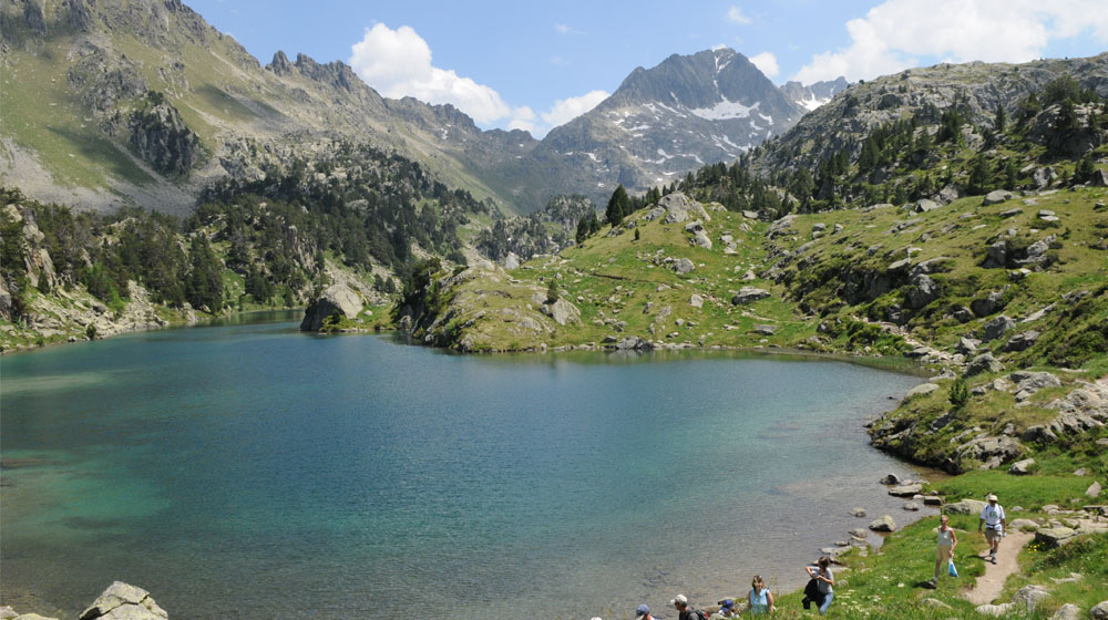
The lake laden Colomèrs basin is a mountain range formed in the shape of a circle which holds in its basin nearly 50 lakes (estanhs). The slow, but efficient process of erosion of ice from the glacier era left behind the legacy of an incomparable landscape. The access to the refuge is worth the effort to get there. The surroundings in this high mountain landscape with high and steep mountain peaks reaching 3000 m in altitude are simply breathtaking. The Creu de Colomèrs, the Gran Tuc de Colomèrs and the Tuc de Ratera are a few of the more emblematic peaks of this range. The proposed hike is a circular route passing by the nearest lakes to the entrance of the Colomèrs basin. You will pass by 7 completely different lakes.

Detailed Route:

From the taxi stop at Montanheta a sign indicates a trail which goes up until reaching the first lake, Lòssa Lake. Once you have arrived to the river take the trail to the right (without crossing the river) until you reach the Colomèrs refuge (1). Leave the dam on your left and follow the trail nearest to the Major Lake of Colomèrs (2) until the refuge. You will go around the lake on a somewhat uncomfortable trail which becomes quite slippery and steep when it rains. You will continue on until reaching the Mòrt Lake and will go around it on the left side. After going up a small canal the yellow marks separate from the red ones. (3) Follow the yellow marks to the left which will take you to the Garguilhs de Jos Lake. You will go around and over the stream coming from the lake. The trail goes up, down and around another stream. To the left below a chasm there is an area of stagnant water. You will go down a small basin and then go up a small hill which will lead you to the Cabidornats Lake. Go around the lake on the left side following the yellow marks until you reach the Long Lake (4). Continue along on the left to the beginning of Estanh Lake (5) and later turn left on the GR which leads to the Còth de Clòto pass where you will see the Clòto de Baish Lake. After passing over the saddle you will descend until the trail splits. Take the trail to the right until it joins the first crossing next to the river. Walk the last part of the trail until the stating point.

Curiosities:

The glacial lakes were formed when the glaciers withdrew from the great basins leaving behind large chasms in the earth which have now converted into lakes. The stones and boulders scattered throughout the landscape were at once part of great slabs of granite which were moved by the retreat of the glaciers. The gentiana flowering plant (genciana acaulis) with is violet blue colour is a plant which buries its roots underground and from one plant spring forth a number of flowers scattered about. It is interesting to note that the first flowers take 12 years to bloom. Another plant from this area known as aconite (aconitum napelus) is one of the more toxic plants known to be mortal even in small doses. It is used as a painkiller in cataplasms for gout or rheumatism.