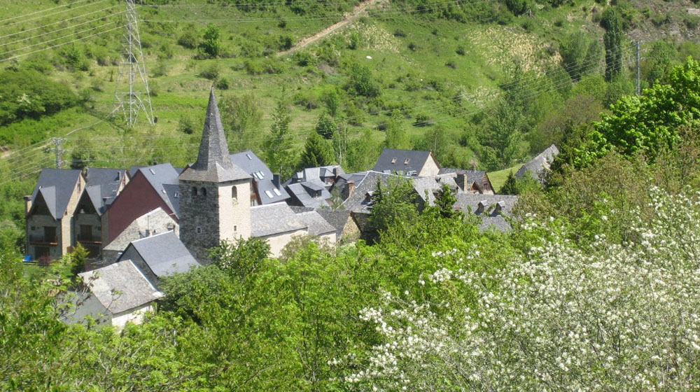
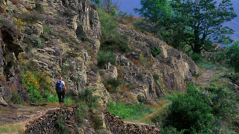
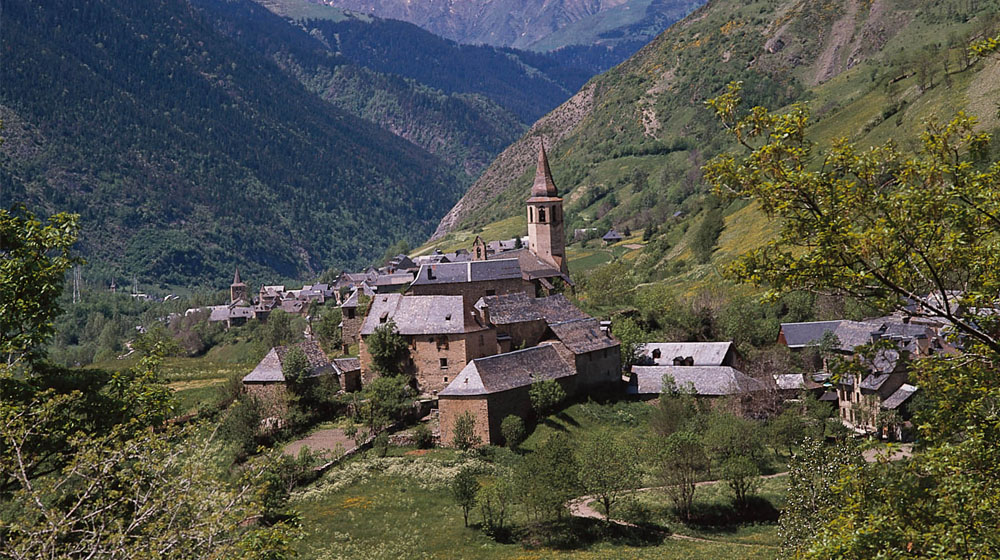
Estanh Restanca

16

Pontet de Rius | Restanca | Raspes de Rius | Barranc de Rius | Pontet de Rius

Technical data

Diffficulty: Difficult

Type: Hiking

Distance: 5,5 km

Time: 3h

Elevation: 440m

Description

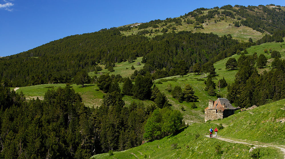
In the village of Arties the Valarties valley begins. Its green fields contrast with the coniferous forests and the imposing peak of Montardo. The itinerary is a introduction to hiking in the high mountain region between precipitous peaks, rock fields and lakes. It is part of the hike up the Montardo Mountain. You will hike through fir and black pine forests laden with intermittent berry bushes and red elders. Plants such as the rhododendron stand out with their red flowers at the beginning of the summer and the blackberry and raspberry bushes also flourish in this area. These are a favourite for the local fauna. The forests are full of animals such as the wild boar, the roe deer, fox and the marten. Outside of this area and at a higher altitude the most abundant animal is the chamois (a goat like animal). Next in number are the marmot and these are followed by the restless stoat or short tailed weasel.

Detailed Route:

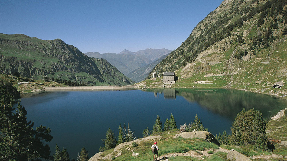
Starting point is the Pontet de Rius passing by the cabin turn left following the GR-11 marks. The trail ascends an irregular path although well defined which sweeps through the thick forest of pine and fir trees. Upon reaching the top of the first ascent take the trail leading to the right and continue along progressively gaining altitude. The dam of the Restanca lake becomes visible once the forest opens up and you reach the lake itself. The Restanca refuge is on the other side of the dam (1). Behind the refuge you will see the steeps cliffs of Agulhes deth Montardo. The itinerary continues without crossing over the dam. The GR 211 goes to the right and goes over a small pass. The trail follows the base of the Tossal del Mar. There is a descent of about 100 meters to reach a small valley where you can see the exit point. You will hike along a small rock field still following the GR marks and you will traverse alongside the Raspes de Rius. Where the trail approaches the river leave the GR (2) to go to the right looking for the Barranc (ravine) de Rius. Cross the river on a large stone slab and continue along a trail at times well marked and other times covered with grass and flowers while descending the Rius Valley. Passing the Rius cabin the cairns (rock markers) are more visible taking you finally to the starting point.

Recommendations:

Take the time to reach the Mar Lake or the Cap deth Port Lake. Consult with the refuge keepers before beginning these excursions.

Curiosities:

The remains of buildings and tunnels from the past are remnants of constructions begun in the 40’s to bring the mountain’s waters to the hydroelectric centre of Valarties. This was an immense project with dams and 19 km of tunnels and galleries connecting the lakes to the heart of Valarties and neighbours of Colomèrs and Saboredo. The rhododendron (rhododendron ferrugineum) produce irregular shapes yellow in colour called “agallas”. They are like tumours provoked by insects, fungus or bacteria and serve as the plants’ defence against intruders. The “marmot oil” is the oil from the macerated rhododendron. It is often used as an anti-rheumatic and anti-inflammatory medicine. The chamois is the most characteristic mammal of the Aran Valley. It lives between 1000 and 3000 meters above sea level. In the winter they descend to the top border of the forest and in the summer they go up the mountain in search of the best pastures and snow covered areas.

Saubaga, a stroll through Lower Aran

5

Bossòst | St.Joan Crisòstom | Carretera deth Portilhon | Bossòst

Technical data

Diffficulty: Difficult

Type: Hiking

Distance: 5,4 km

Time: 2h 40′

Elevation: 450m

Description

This itinerary takes the hiker along old trails and paths around the village of Bossost. You will enjoy an incredible landscape with a very varied vegetation typical of the mountain terrain: chestnut, oak, alder and maple trees abound and on the path to the Portilhon you will find beech tree and fir tree forests with excellent views of the Tùc dera Entecada (Entecada Peak) and the Tuc de Mieidia (Mieidia Peak) along with the village of Bossost and the Montlude mountain ridge.

Detailed Route:

Starting point is the patio of the tower of the Saint Mary church of Bossost. Take the Sant Joan Crisostom street across the village towards the mountain along the narrow streets until you reach the St. Joan Crisòstom chapel. Continue until there is a split in the road with a sign and take the direction of “Itinerario de Saubaga” along the Casteràs ravine. (1) Follow along uphill and leave the trail taking the barely visible path ahead between the field and the ravine which soon becomes a more visible trail. At the next split in the trail go left on the rock cobbled trail in a hazelnut tree forest. The ascent flattens out and the trail widens. After various ravines and old remodelled barns you will arrive to a cross with a forest road which comes from Portilhon (2). Take the road to the left and follow the PR indications. An easy descent begins which leads to a crossing indicated as “Camin de Saubaga, Bossost (3). Take this trail going down a steep slope (be careful in the autumn and spring) which takes you to the Portilhon road (4). You will reach the trail again on the left hand side following the PR marks. After crossing the Samorera ravine you will arrive once again to the village of Bossost.

Recomendaciones:

A must do while in Bossost is taking a walk along its pleasant and welcoming streets and visiting its shops. A visit to the Romanesque church of Santa Maria of Bossost (XII century) is one of the most beautiful examples of pure Aranes Romanesque style.

Curiosities:

Surrounding Bossost you can find 6 different chapels (originally there were 7). Following the tradition, they were built to keep the villages free of the cholera and plague epidemics. Crossing the Garona River you will find the old “bocard” or mineral washing basin. The raw minerals were transported along an aerial cable system with an elevation drop of 610 m and a distance of 2200 m from the Victoria Mine.

Along the Footsteps of the Past

4

Les | Bausen | Les

Technical data

Diffficulty: Moderate

Type: Hiking

Distance: 8,3 km

Time: 3h 20′

Elevation: 310m

Description

The itinerary passes through shepherding land, between retaining walls and barns which appear in hidden corners and makes one remember the life in times past of the Aran Valley. The path travels through old oaks and thick forests full of a variety of vegetation. The “Guardader de Vernet” surprises with its excellent panoramic view of the Baish (lower) Aran and its image of the saint hidden in a log as well as its refreshing river in the Bausen ravine. The peculiar village of Bausen where it seems as if time doesn’t pass is worth a visit. Following the village you will certainly enjoy the magnificent fields of the Era Lana de Les.

Detailed Route:

Starting point is the town hall square of Les. Go to the N-230 highway in direction to France until finding the asphalted road on the left before the hostel. At the crossroads you will follow the GR-211-2 towards Bausen. Further along the road splits and you will continue to the left looking for the GR marks which indicate a rock cobbled path which goes up and zig -zags between retaining walls, fields and barns. After passing two buildings and an animal trough you will continue along the path which goes up to the left until reaching another crossing. Follow this to the right in the direction of Bausen and shortly you will reach the “Guardader de Vernet”. Continue along a narrower trail which flanks the mountain. Soon you will re-enter the forest and arrive to the Bausen ravine. Continue until you reach the next crossing and then travel along the forest trail to the right until reaching Bausen. From the San Pere street take the Santa Eulària street which goes to the right and after take the path which goes down to the left to then depart the village. To the right you will see the Santa Anna chapel. Continue down the path which crosses the road to Bausen on two occasions. Upon arriving to the N-230 highway cross it and take the local road until you cross the Garona River. You will return to Les along the GR-211 passing by the San Blai chapel and the old Les Baths.

Recommendations:

The Haro Square in Les and the Hot Springs of Baronia.

Curiosities:

The tradition of the burning of “The Haro” in Les continues today. In this ceremony a large log opened with wedges is stood upright in the square with its same name (Haro). This is done in honour of Saint Peter adding a flower wreath to the log. The following year the Haro is burned the night of Saint John during a grand annual party. Long ago the roofs were made with straw. They had a thickness of up to 80 cm which became a good insulator in the winter. In addition to breathing well this straw helped in the conservation of the grass inside the barn. It could last up to 45 years. The steps which were normally oriented to the north or east had the function of protecting the grass from the wind and rain and they permitted rooftop access for maintenance and fire prevention. Fires were the principal cause of the change of the rooftop materials of the Aranese houses at the end of the XIX century going from straw to slate.

The Paliàs Path

6

Bossòst | Camin des Plaiàs | Les | Bossòst

Technical data

Diffficulty: Moderate

Type: Hiking

Distance: 7,8 km

Time: 3h

Elevation: 380m

Description

This itinerary offers a route between the villages of Bossost and Les. The first half is along the Paliàs Path in the mountain area known as Malh Blanc with varied vegetation predominated by hazelnut and birch trees. As the slope changes its steepness there is more shade and you will find beech trees. The views towards the Montlude mountain ridge and the Uishèra Mountain are remarkable. The return is along the valley adjacent to the Garona River on a comfortable and easy trail. The nearness to the French border has encouraged these villages to develop strong historical and commercial relations with France which still continue today.

Detailed Route:

Starting point is the Bossost church square. Take the Carrer Major street until you reach the Sant Roc chapel. Continue ahead until seeing a yellow marker. Continue the ascent on an isolated rock cobbled path. On the ascent you will find several splits it the path towards the left. Take the rock cobbled path upwards that has the wooden hand rail and which passes a fountain. The path narrows and widens due to the access trails to the new remodelled farm houses. You will cross two streams. After crossing the second stream you will come to a farm house (on the left) which can be identified by two large rocks placed on the trail entrance. Just following this marker take the trail which is not very noticeable and which zig-zags rapidly up the hazelnut tree forest. Go up the last part of curves and the trail continues going through a beech tree forest. After passing a few old barns you will descend the mountain passing several streams. An old barn covered with vegetation marks the forest end. Take the trail to the right which reaches the cement Serís Bridge and crossing a wide trail (1) you will go down path in the centre on a steep ramp. You will enter Les on the Benqué road. Cross the N-230 highway ahead and cross the Garona River. On the right of the river bank you will see the Les Residence, a park and camping area. Follow the red and white marks of the GR-211 of the “Camin Reiau” following the Garona River will take you to Bossost.

Recommendations:

On your way to Bossost along the “Camin Reiau” just besides the Cledes hydroelectric centre there is a fish hatchery of Sturgeon fish specializing in the production of caviar. Guided visits are available.

Curiosities:

In the Aranese the term used for barn is “borda”. A “borda” is a building inside or outside the village used in the winter to store hay and as a stable for the animals while in the summer the “bordas” in the mountains where shelters for the shepherds when their livestock was grazing freely. The hazelnut tree which can be found along the majority of the itineraries was largely used in this valley to build all types of baskets due to its strength and flexibility.

A riverside hike in the Castiero villages

14

Vielha | Escunhau-Casarilh | Vielha

Technical data

Diffficulty: Moderate

Type: Hiking

Distance: 8 km

Time: 2h 40′

Elevation: 300m

Description

This itinerary follows part of the trail which goes up to the old ski resort, La Tuca. The trail passes through a shady forest rich in ash, maple and oak trees until reaching Escunhau and Casarilh. From this trail one can view Vielha located at the crossing of the Nere and Garona Rivers from an excellent aerial viewpoint. The return portion along the sunny side is on a well positioned trail above a rock laden hillside between pasture lands and open fields with a variety of shrubs (blackthorns and hawthornes – crateaegus monogyna) and rose bushes joined by the lullaby of the river.

Detailed Route:

From the Plaça de Vielha dera Gleiser go up the street Sarriulèra. Outside the village, in the crossroads, take the GR-211-1 on the left, which amounts to the visible antennas. It continues to the junction and take right track Tuca forestry. On the way down the runway is the Costassa, a lawn with tables and a fountain that invites to stop and refresh. Continue along it to a crossroads that says “Estanhot d’Escunhau.” Follow the diversion of the left of the label for brands GR. You get to the people of Escunhau at the height of the Romanesque church of Sant Peiro. It is right by the GR. At the next crossroads continue Casarilh address. You enter the village and down all right across the road C-28 to a fork that is caught on the left to bind to the GR-211. A nice bridge we can cross the river Garonne. The road gains altitude and Flanking takes a dramatic turn Vielha, near the new sports hall and Palai of USG. Follow the right bank of the Garonne river to a wooden bridge. It borders the Hospital and the street Arnals you get the point of departure.

Curiosities:

The Vielha church square was the patio of the armoury of the old Vielha castle built near 1345 as a common fortress for the consuls of Vielha, Gausac and Casau. It was built during the Guerra dels Segadors in 1613 (the war of the harvesters). Before arriving to Escunhau in the area known as Castièro which gives the name of the region “terçon” there was another castle of which today there are some remains. The ivy which can be found in abundance in these parts of the valley climb trunks of old trees with their adherent roots. Being perennial plants they stay green throughout the year growing curiously on all types of deciduous trees.

Mina Victòria

7

Arres de Sus | Bassa d’Arres | Mina Victòria | Bassa d’Arres | Arres de Sus

Technical data

Diffficulty: Moderate

Type: Hiking

Distance: 5,1 km

Time: 2h 15′

Elevation: 360m

Description

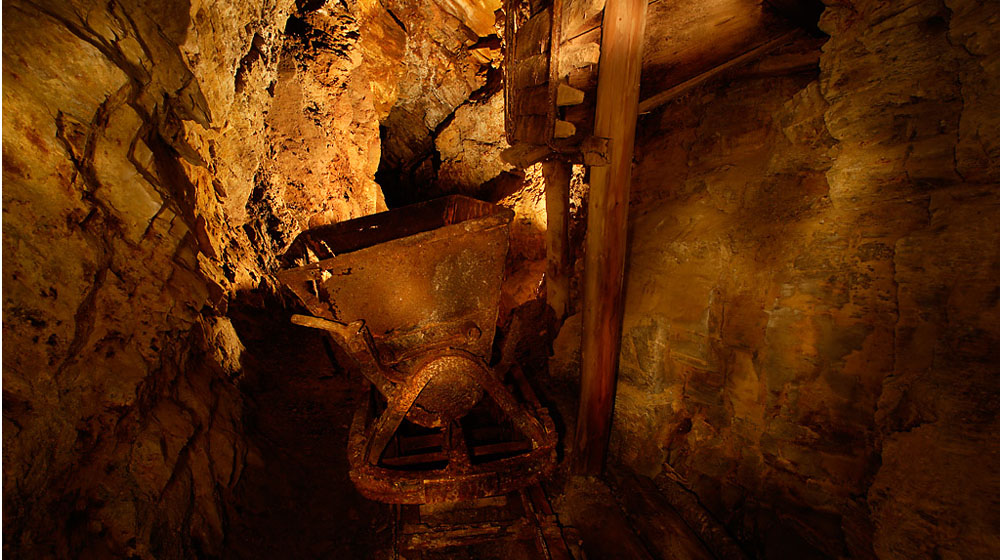
This route shows the visitor the dificult work conditions the miners experienced during the first half of the XX century. It is a bucolic route through fields, gullies, steep black pine and fir tree forests with spectacular views. A part of the route one can see the surroundings of the mines: the lookout, the foreman’s house, the buildings where the workers lived, the latrine or the remains of the cable railway used to transport materials. The machine room is the starting point for the guided visits in the summer. The return is on a trail prepared with logs and follows the entrances of the superior galleries which follow the principal seam of the mine. To make the last ascent worthwile there is a picnic area in the Arres Pond (bassa) where a good observer can distinguish the newts of the tadpoles before returning to Arres de Sus.

Route:

Strating point is the Plaça Major de Arres de Sus going up the ramp of Camin des Prats leaving the Glèisa of Sant Joan to the right. You will pass the last houses and at the split of the path take the trail to the left which crosses the forest road and the pastures several times until reaching the Victòria Mine itinerary which is well sgnalled. Go gradually downhill to the exploitation area, where the Machine Room is the location for the visitor centre. After visiting these buildings you will continue going up log based steps following the different galleries and mine entrances. You will cross various ravines and following a fir tree forest you will arrive to the Bassa de Arres. Follow the forest road down until you find the path uphill and then return once again to Arres de Sus.

Recommendations:

A guided visit to Sacosta Gallery of the Victòria Mine. ( The guided visits are only in the summer season).

Curiosities:

At the beginning of the XX century the zinc and lead exploitation in the area of Arres was significant. In 1912 the Victòria Mine was in full operation. This same year the mineral washing area or “bocard”, of Bossòst was operated basically by women and children who had the difficult job of separating the minerals from the raw material. Beforehand, a selection (sift) of the raw material had been made near the mine which was then transported by mules. This mine was the most important of the valley given that its location allowed it to be operated year round. The newt of the Pyrenees (euproctus asper) is an amphibian species of the Pyrenees. It measures 16cm with a dark brown colour on its backside and rough skin with a slitner of orange on the ventral side. It lives in the cold mountain waters. In mating season they spend hours curled up with one another. The digitalis plant ( digitalis purpurea) is a very attractive plant with clusters of purple red flowers, but it is an extremely toxic plant as well. In medicine it is used in small doses as a cardiac tonic (digitalina) in the case of a heart attack.

The Beech Trees of Carlac

3

Bausen | Ermita de Sant Roc | Bordes de Carlac | Coret de Pan | Bausen

Technical data

Diffficulty: Moderate

Type: Hiking

Distance: 5,0 km

Time: 2h

Elevation: 275m

Description

Bausen is an enchanting village hidden where the slopes of the Vacanera mountain smooth out slightly allowing the establishment of a village with fields and farmland in their surroundings. The approach is made travelling along a local winding road which gains altitude above the Garona River. The village maintains and old love story. The route takes the hiker along the mountain sides on a well marked and travelled path and later enters a spectacular beech tree forest where small remnants of a long ago civilization can be seen such as an animal trough made of big stone slabs, old barns scattered around the mountains or a wooden footbridge. These simply make the trail come alive with history. The hiker will return to the light of the day and the panoramic views of above Bausen and Baish (lower) Aran once you pass the Coret de Pan.

Detailed route:

Starting point is the car park at the entrance of the village and continues along the Sant Pere road where a sign indicates the direction up the steep roads. Continue following the GR marks to the right until reaching the outskirts of the village. You will pass by the San Ròc Chapel and will leave the behind the antennas to the right. The well constructed path will flatten out and as you continue along the forest thickens, but the path does not disappear. Pass by an animal trough and an old barn and you will cross a stream on a footbridge. Further along there is a split in the trail and you will follow the GR to the left where it is more uphill. The majority of the elevation gain is on this section of the hike. You will reach the furthest point of this hike. After a brief rest you will return to the same stream without a footbridge. The trail flattens out until exiting the forest. You will pass the Coret de Pan and continue between the fields with old “bordas” (barn houses) scattered about until you reach the rooftops of the village of Bausen.

Recommendations:

Visit the covered trough in the direction of the Bosc (forest) of Saplan or visit Teresa’s Cementary

Curiosities:

A the beginning of the XX century two youngsters much in love asked the priest for permission to get married, but due to the fact that they were related he was unwilling to grant their wish if they didn’t pay a “dispensa” (dispensation) the church required. They were poor youngsters and didn’t want to pay. After many pleas to the priest they decided to live together. They day that Teresa died at only 33 years of age the priest was unwilling to bury her in the church’s cemetery. The entire village united to build a civil cemetery on the outskirst of Bausen for Teresa in a quiet and peaceful corner. The Alpine Chough bird with completely black feathers, a yellow beak and red feet amaze the viewer with its incredible flight as they take advantage of the air currents to do daring acrobatics. They nest above 1800m, are very sociable and when the weather is cold often descend to the lower regions of the valley.

The Corilha Ravine

17

Unha | Barranc de Corilha | Gessa | Unha

Technical data

Diffficulty: Moderate

Type: Hiking

Distance: 3,6 km

Time: 1h 30′

Elevation: 330m

Description

This itinerary connects the villages of Unha and Gessa. You will be taken through a small forest of oak, ash, cherry and hazelnut trees and will pass by pastures close to the villages on the side slope of the Pui de Unha. The peak of which reaches 1000 m above and descends next to the pleasant river which exits from the Corilha Ravine. Here you have an impressive panoramic view of the valley, the mountains, the villages of the Pujolo region and the Maladeta mountain range off in the distance.

Detailed Route:

The starting point is the car park in the centre of Unha. Go up the Carrer Major street until reaching the Carrer Sant Martin street at the end of which begins a fast ascent. After gaining the majority of the altitude of this hike, flank to the side to enjoy the incredible views. Following another zig zagging ascent exit the forest and go up the pastures following the posts with the yellow markers. Pass a rock field and you will soon encounter a crossing of trails with indications (1). Follow directions of the PR-112 towards Gessa. The path is going to head towards the Corilha Ravine and will descend to Gessa. Once in Gessa continue along the Carrèr Riu street until reaching the bridge (2). Go up this street in the opposite direction of the bridge and pass just next to the Saint Pere church and Casa Rosa. You will soon reach the roundabout where another sign will indicate the direction to take to return to Unha. You will enter Unha on the Carrèr Major street.

Recommendations:

In Unha: the Romanesque church of Saint Eulària, Ço de Brastes and the flour mill. In Gessa one should visit the Casa Rosa which is a mansion with an angled tower and Renaissance windows.

Curiosities:

The “terçons” are internal territorial divisions of the Aran Valley. In Unha the Ço de Brastet is a mansion from the 16th century and is one of the civil buildings with a military function most representative of Aran. The lion’s tooth (taraxacum) is a vigorous plant with yellow flowers very common along the paths of Aran. Its soft leaves can be eaten in salads and have cleansing and diuretic effects on the digestive system. It is of great interest in the bee industry worldwide due to the nectar and pollen they produce. The Eurasian Jay is a small bird belonging to the family of the crow and similar in size is easily heard and seen as it flies between the trees. It has attractive feathers, brown in colour with a white spot and blue and black stripes on its wings.

Giant fir route

22

Cabana de Loseron | Coma des Estrets | Cabana de Loseron

Technical data

Diffficulty: Easy

Type: Hiking

Distance: 1,8 km

Time: 1h 30″

Elevation: 185m

Description

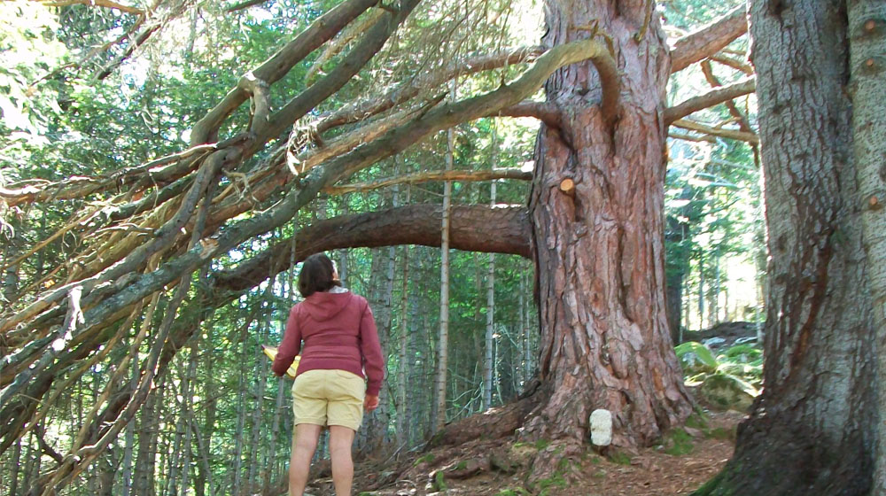
The route is not of great difficult. It is also well signposted, and has 10 panels with educational presentations on the large trees that you will find on your way. The route is in the valley of Valarties (side valley of the Garonne River), within the periphery of National Park and Sant Maurici Aigüestortes.

Detailed Itinerary:

If you start from Vielha, take the road C-28 in the direction of Puerto de la Bonaigua. Upon reaching the height of Arties, take the detour to the right, which is right after finishing the population. Past the first bridge that crosses the river Garonne, you will see before you the Arties hydroelectric plant. Continue right up through the town square of Arties, where you will find the bridge over the river Valarties, cross it, and quickly turn left heading towards the valley of Valarties. After leaving behind the last buildings of the town begins the forest track, which you must follow until you reach the bridge of Ressèc. Here you have the option of taking a taxi up to the cabin of Loseron, or else make the journey on foot down the track for 3 km through a forest of beautiful spruce.
When we find Loseron hut (1,630 meters high), in an environment of alpine meadows full of flowers, on its wall you will see an information panel that explains briefly the itinerary, and in the general colors of the poster you will see the direction you need to follow to start finding the giant spruce. Go down the track a few meters, and passing the small bridge, you will find a first indication of the expected time to do all the itinerary.
Go through some initial fields and, following the yellow wooden signs, head into the woods. Then take the path of an old canal, and continue straight, without losing any altitude. At one point, on the left, when the signs of broken branches begin to take you up the slope, try to find a large red pine with panel 001, which teaches us how to measure the height of the trees an easy way. From here we will find the rest of the trees and notice boards with different information, interesting facts ..
The tree 002 will serve to guide you. In the tree 003 you will see a cross section that teaches how to count the years of the trees. Then you will see two trees that come together in the panel 004, and thus learn to differentiate red pine from firs. Then the panel 005 tells a beautiful story of an old road. Continue straight until you reach a path on the left, where you will find the tree 006, with a beard hanging down. Next to it, your eyes have to get to heaven to see the tall firs of group 007. Further, the panel 008 is in a great tree whose branches form a dense shade, and then the panel 009, a towering tree with its giant roots anchoring to life. Just at this point is where the road turns to reach the last tree with panel 010, which, despite being dead, gives us a lot of indormation about the place. You have arrived! and now you can start the descent on the way down, a little wild and fun at first, but then you just have to go to the tree 006 where we find the road uphill, and follow it. Return to the bridge, near the hut Loseron, where there was the first exhibition panel.

Recommendations:

The bravest can try to gown down straight from the tree 001, looking for the old road to the track. Then, a network of trails made to remove the timber from the forest will lead you to Sieja Meadows, near Ressèc bridge. You have to wear good shoes.

Trivia:

In Arties, past the hydroelectric plant, just after you turn right towards the town, it is worth stopping to see the bears in captivity. If you like architecture, you can enjoy in this town the visits to the church of Santa Maria and the church of Sant Joan, the latter alongside the road.

Montgarri, a sanctuary at the limit of Aran

20

Beret | Sanctuario de Montgarri | Montgarri | Montgarri | Beret

Technical data

Diffficulty: Easy

Type: Hiking

Distance: 12,6 km

Time: 3h

Elevation: 200m

Description

The Beret Flats were at one time the scenario for witches and sorcerers practicing the dark arts on this great mountain plateau at 1850 meters. Here one is witness to significant contrasts from the snow covered mountains and skiers in the winter to the summer pastures full of livestock grazing gingerly in the sun. The area is exceptionally located in that it is the natural border between the Atlantic facing slope to north and Mediterranean slope to the south. The itinerary goes down along the side of the Noguera Pallaresa River (1) and goes through black pine tree forests and pastures until reaching the refuge and Montgarri Sanctuary which are located in an open and sunny spot next to the river. The return portion of the journey is on the forest path on the shady side of the river in the fir tree forest of the Dossau Mountain.

Detailed Route:

The starting point is the car park of the Beret Flats to the left of the large warehouse. You will quickly locate the GR sign. The trail which you will take is well defined, wide and easy. The trail goes through pastures and later enters the forest. You will cross several streams, the Parròs Cabin and the Horcalh River after which you will reach the Es de Cabau barn. (1) Here the trail narrows a bit, but shortly you will arrive to the refuge and Montgarri Sanctuary. Go across the bridge and continue until you reach the ruins of houses of long ago from an old village. This route unites with the trail which comes up from Alòs d’Isil (2). Go to the right. Further on there is a car park indicating the entrance to the Sanctuary from the other side. When leaving the Sanctuary you will continue going up progressively along the forested mountainsides of the Beret Flats.

Recommendations:

The Uelhs of Garona and the Noguera Pallaresa River along with the incredible panoramic views from the Beret access road. The menhirs of the Beret Flat and an excursion to the area of Orri where the Malo river appears and disappears are worth visiting. In Montgarri, if you cross the Noguera Pallaresa you will find some marvellous ponds and waterfalls.

Curiosities:

The image of the Montgarri Virgen was discovered by a shepherd who watched as one of his cattle knelt down each day in the same spot at which time he decided to go investigate. To his surprise he discovered the image and Montgarri was named the patron saint of the shepherds and to whom they built a chapel. The Sanctuary was later built.