A walk through the Heart of Toran

1

Era Honeria | Eth Pradet | Era Honeria

Technical data

Diffficulty: Easy

Type: Hiking

Distance: 2,3 km

Time: 45′

Elevation: 100m

Description

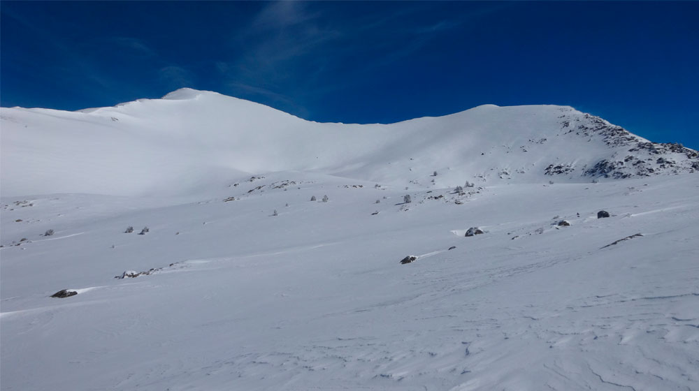
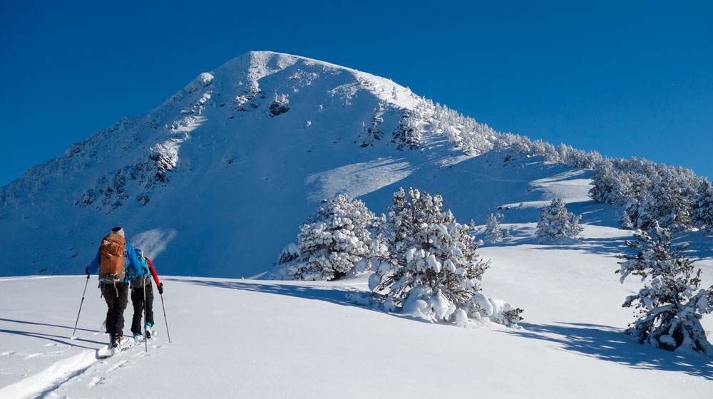
The stroll is a short and beautiful path which takes the visitor to the hidden village of Pradet. The waterfall and the Toran river adjacent to the road are an excellent starting point. The Tuc d’Ermer (Ermer Peak) looks over the valley proudly showing its green vertical slopes while hiding snow in its forests well into the summer. Its hillsides are covered with thick fir and beech tree forests. This makes an ideal location for the timid bear who doesn’t understand borders. In addition, the Toran River adds a bit of mystery to the hike as its water appears and disappears completing part of its journey underground when the water level decreases.

Detailed Route:

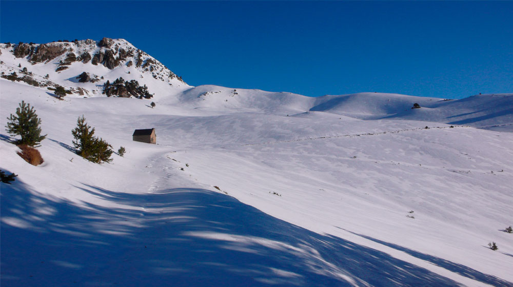
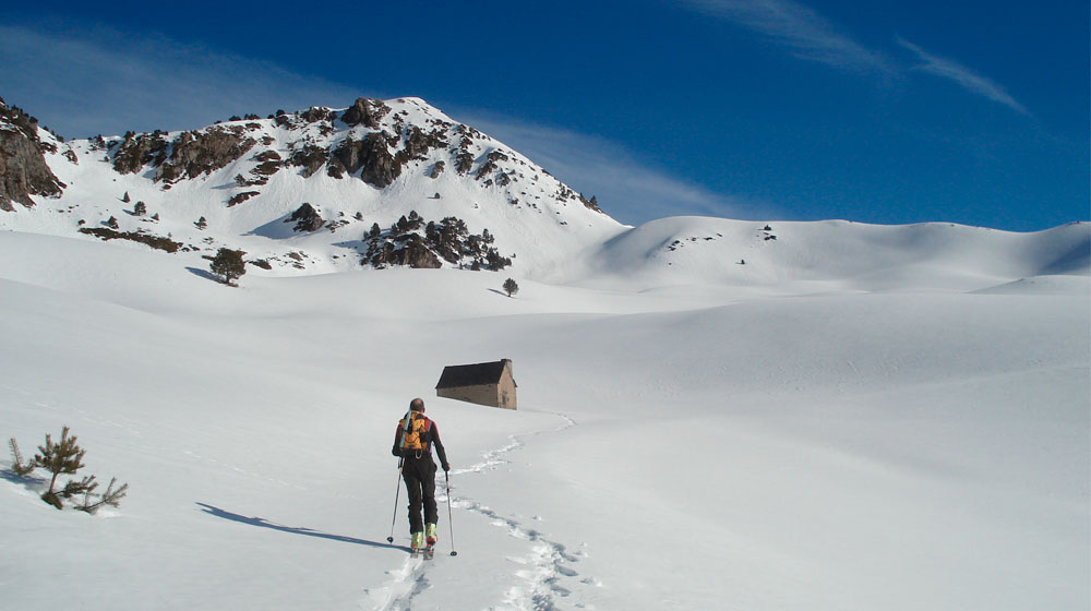
Starting point is the car park next to the Era Honeria refuge (cabin). Begin by walking straight along the road until reaching the first curve at which point you take the path which starts at the curve and follows the course of the river. (1). This trail goes into the forest until it reaches the river. Cross the river using the rocks. Then follow along slowly going up the other side until reaching the crossroads. (2). Turn to the left between the ruins of the old farm houses. Although the trail gets narrow, it is well marked. Take the time to enjoy the beautiful views from the position overlooking the fields and the valley. You will cross a few small streams and then will arrive to a trough for the animals and a rock area to stop and refresh. Shortly afterwards you will arrive to Eth Pradet. Follow along the road which will split (3) and you will want to continue to the left until the reaching the principal road which then will lead you to the starting point.

Recommendations:

A visit to the villages of Sant Joan de Toran, Porcingles and Canejan or a hike to the Hons dera Coma embalse (dam).

Curiosities:

Near the Era Honeria refuge there was once an iron foundry. Long ago the valley was very populated. Canejan at one point had over 500 inhabitants. St. John’s Wart (hipericum maculatum) is quite abundant in the valley. The yellow flowers with black points on its pedals are one of the most well known plants for medicinal purposes. Among its multiple uses the hipérico oil is used for bruises, cuts and sprains. It is also used in homeopathy and as an anti-depression medicine. The brown bear (ursus arctos) is a timid and solitary mammal which prefers to live in the beech, fir and oak forests because its fruit along with raspberries and blueberries make up the base of its diet. The bears, in addition, have the peculiar ability to hold off the development of the fertilized egg until the environmental conditions are more favourable.

Còth de Varradós

Còth de Varradós

Technical data

Diffficulty: Moderate

Technical difficulty:S2

Modality: Snowshoes

Longitude: 11 km

Ascent time 3h and descent 2h30

Elevation: +610

Clase terreno de aludes: Simple

Descripción

The valley of the River Unhola from the village of Bagergue is long and deep, flanked on both sides by steep slopes and avalanche-prone channels. In La Ribèra, the sweeping expanse after Bagergue flows into the secondary Moredo ravine. The snowshoe itinerary we propose follows this ravine and roughly the route of the summer track to the Còth de Varradòs. Throughout the walk, you can admire sweeping views of the entire Unhòla valley and, as you get higher and higher, the Tuc de Maubèrme and the adjacent peaks. The route doesn’t go through technical terrain, but given the difference in height and especially the distance, we’d recommend setting aside a whole day for it. It’s also advisable to choose a clear day to enjoy the views and also find your way round in an area with few references in the foreground.

When there’s snow on the valley floor, you can start off from the village of Bagergue, or if the track is clear, you can save yourself a long flat stretch to La Bòrda from Peró. From here, the safest option to climb up to the Plan de Moredo, to avoid exposing yourself to the avalanche-prone slopes of Pala de Hèr, is by following the summer path on the south-facing side and crossing the Moredo ravine at the highest and least sandwiched-in portion. Then you’ll reach the Moredo pass and the shepherd’s hut of the same name. Continue until the flat part and you’ll see the pass to the northwest. You can avoid the winding summer track by going up the progressive slopes, preferably looking for ridges and avoiding valleys with small ravines, until reaching the Còth de Varradòs. If you still have energy and the time, and you want to go up a bit further to see more views, with relative ease you can head up the Malhs de Tartèra, to the north of the pass, to the height of 2360 m. The downhill route will follow the uphill one.

Tuc de Vacivèr

Tuc de Vacivèr | Ruta Clàssica

Technical data

Diffficulty: Easy

Technical difficulty:BE-S3

Modality: Ski mountaineering

Longitude: 8 km

Ascent time 2h30 and descent 1h

Elevation: +785

Class avalanche terrain: Defiant

Description

Surely the most popular uphill ski in the Val d’Aran Valley, both for ease of access and the ascent itself, as well as the variety and sheer beauty of the scenery. Although the route starts from the Orri car park at the ski resort, the ski lifts and slopes are soon forgotten as you enter the black pine forest and climb the hanging valley leading to the top. From here you’ll get an excellent view of the northern part of the Val d’Aran and the nearby Vacivèr and Clòt der Os cirques.

From the car park in Orri, take the Arriu Malo valley, between Cabo de Baqueira and Tuc de Vacivèr. You’ll reach a flatter area without forest, and then keep on looking for clearings among the pine trees. Before the valley opens out, go back through a more marked valley to the north and look for the track through the pine trees, climbing up through valleys and small channels. Leave behind the final pine trees and you’ll access the hanging valley that leads to the Vacivèr, with the summit slope ahead of you. Walk up the right side of this slope, looking for the crest and avoiding the central part, right to the summit.

You can make the descent along the same uphill route, or you can head down the central part of the southern slope. This is a south-facing slope, reaching 35° at times, and you can only go down in stable snow conditions.

Plan d'Uishèra

Uishèra

Technical data

Diffficulty: Moderate

Technical difficulty:S1

Modality: Snowshoes

Longitude: 9 km

Time: 2h50

Elevation: +610

Class avalanche terrain: Simple

Description

At the foot of the sunny and elevated villages of Vilamós and Arres, the mountains of Uishèra and Montlude rise majestically and can be seen from many parts of the Val d’Aran. Without having to tackle the steep difference in height, distance and technical difficulties involved in the ascent, here we propose a snowshoe excursion to the Plan d’Uishèra, where you’ll be rewarded with a spectacular view of the Garonne valley and the entire crest of mountains that separate the Val d’Aran from the southern side of the Pyrenees. This is also a privileged vantage point to admire the Pico de Aneto and Maladeta, as well as the 3000-metre-plus peaks of Luchon.

From Arres de Sos, you can normally go by car on the initially paved track towards Bassa d’Arres, up to the curve where the village oil tank is found. Start climbing up northwards over the gently-sloping open meadows until reaching the track that by now has split into two. Take it towards the east, which climbs up through red pine forest. After two sharp turns you’ll find a small stone hut on the left (1725 m elevation). Walk up this clearing for 50 metres in a northeasterly direction until you see an old wooden trail, quite hidden due to disuse, which climbs diagonally. Take it and continue in a southeasterly direction, again within the beautifully secluded red pine forest, where among the trees you’ll often spot roe deer, deer and other wildlife. Depending on the thickness of snow, it may be tricky to make out this trail. For reference, you should come out on the wide curve at 1875 m on the same track that you left behind previously. Return to the track again and stay on it until the Plan d’Uishèra. In this last part, the forest will be progressively clearer and open out to give you the desired views. In the Plan d’Uishera you’ll find a shepherd’s hut bearing the same name. The return can be along the uphill route or following the forest track.

Tuc dera Salana

Tuc de Salana | Coma de Montanèr

Technical data

Diffficulty: Moderate

Technical difficulty:BE-S3

Modality: Ski mountaineering

Longitude: 10,5 km

Ascent time 3h and descent 1h

Elevation: +1040

Class avalanche terrain: Demanding

Description

The ascent to the clearly visible pyramid of La Salana, thanks to its geographical location, commands unbeatable views of the valley from the summit. The itinerary starts from the Aiguamòg valley, skirts the Coma de Montaner between firs and pines and then comes out at Prüedo, a high flatland with tree cover. From the foot of the pyramid, climb the west ridge to the summit itself, which in good snow conditions can be done with skis on. This isn’t a technically difficult climb, but the route does run through an avalanche-prone area, so remember to pay attention. Besides the itinerary proposed here, the pyramidal shape of the mountain provides multiple lines, which is a true delight for downhill lovers.

From the parking area at Bòrda de Montadí, follow the same track towards the Banys de Tredós. After the last curve, you’ll find the Montaner valley on your right. Head up this varied and fascinating valley. Pay attention to the channels that open up on the left, as when there is fresh or wet snow, they may trigger avalanches that reach the valley floor. The upper part of the valley, before coming out at Pruedo, at the point where you cross the summer track, is a short but steep section where there may be unstable snow drifts. Here it’s better to avoid this terrain and head out of the valley to the right (west) to reach Prüedo safely. With La Salana ahead of you, follow the pretty flatlands and gentle slopes of Prüedo. Avoid the steepest slopes that descend from the north side of the hill and climb up its right. Once you’re on the west-facing edge (towards Montardo), zigzag your way across while keeping as close as possible to the summit.

If you’re uncertain about the stability of the snow, then make your descent following the original uphill route. An attractive alternative descent, if the snow is stable at the top, is the east face (complex terrain) of the pyramid. When the slope becomes less steep, in the flat area of ​​Corrau des Machos, keep going down along one of the small channels to the Banys de Tredós, or turn left to look for other small channels that will bring you down to Coma de Montanèr. Keep in mind that all these small channels are narrow and steep, in other words, deceiving terrain where a small avalanche terrain could have more serious consequences. If you choose to continue your descent on this type of terrain, make sure you feel in control at all times.

Tuc de Ratèra

Tuc de Ratèra | Port de Ratèra

Technical data

Diffficulty: Moderate

Technical difficulty:BE-S3

Modality: Ski mountaineering

Longitude: 6,5 km

Ascent time 2h and descent 1h

Elevation: +570

Class avalanche terrain: Complex

Description

Tuc de Ratèra is the highest mountain in the Saboredo cirque. You can make it out from the Saboredo Mountain Shelter thanks to its tall and elegant east- and south-facing slopes, which in good conditions provide a long and steady descent. The itinerary is short and direct, ideal for doing from the shelter if you have only a few hours before returning to the valley or continuing your journey. The views from the top are truly breathtaking, with the Saboredo and Colomers cirques towards the north and the headwaters of the valleys in the National Park of Aigüestortes i Estany de Sant Maurici to the south. Here we’ll review the ascent from the Saboredo Mountain Shelter. Access to the shelter is covered in a separate info sheet.

Head down a few metres from the Saboredo Mountain Shelter to the nearby Estanh deth Miei, continue south on the flat land to the Lac de Naut and from here head up between flatter areas to reach Port de Ratèra. Located at the foot of the pass, it’s best to flank the mountain from below and look for its southern ridge, which is less steep and looks over to Tuc de Bergús. The last few metres to the summit are demanding due to the steep terrain. From the Tuc, the safest downhill option is the more south-facing uphill route. If you’re sure that the stability of the snow hasn’t dropped throughout the morning (the east face gets more hours of sun than the south face) and you’re a confident skier, then you can go for a straighter and more direct descent towards the southeast or east. There are numerous lines of descent, as in general the slope is uniform and doesn’t have any particular uneven ground or traps.

Pòrt de Ratèra

Port de Ratèra

Technical data

Diffficulty: Moderate

Technical difficulty:S2

Modality: Snowshoes

Longitude: 5 km

Time: 3h

Elevation: +300

Class avalanche terrain: Demanding


Description

Pòrt de Ratèra is the wide pass which links the Colomers and Saboredo cirques to the north and the Ratera valley, which spills into Lake Sant Maurici, to the south. The climb from the Saboredo Mountain Shelter is fairly easy and relatively short, ideal if you only have a few hours before returning to the valley. The proposed itinerary is circular and can be done either way round. Here’s the description of the uphill section via the small lakes of Deth Miei and De Naut and downhill via the lakes of De Naut and Major de Saboredo. Access to the shelter is covered in a separate info sheet.

From the Saboredo Mountain Shelter, head down a few metres to the nearby Estanh deth Miei, continue south on the flat land to the Lac de Naut and from here head up between flatter areas to reach Port de Ratèra. Tuc de Ratèra (on our right, west) and Tuc de Bergús (in front, southwest) are like the guards of Pòrt. If we approach, as if to head downhill, the Cometes de Ratèra (south), we’ll see the guard of Lake Sant Mauricia, the Encantats. Head back to Pòrt de Ratera and down the small north-facing valley sheltered by the spires and peaks that form the Sierra de Saboredo. Walk down in a northeasterly direction to the Lac de Naut de Saboredo, and from its far northwest corner head back to the ridge on your left. This ridge takes you up above Lago Mayor and if you keep heading north leads you safely back to the shelter.

Tuc deth Pòrt de Vielha

Tuc deth Pòrt de Vielha | Pontet

Technical data

Diffficulty: Moderate

Technical difficulty:BE-S3

Modality: Ski mountaineering

Longitude: 11 km

Ascent time 4h and descent 2h

Elevation: +1200

Class avalanche terrain: Simple

Description

The Tuc deth Pòrt de Vielha is one of the great ski-friendly classics in the Val d’Aran. Transit point for people, livestock and goods, Pòrt de Vielha is steeped in history. Throughout the centuries, and more so after the opening of the tunnel, it has been one of the most important crossover points between the north and south sides of the central Pyrenees. A point where the waters divide towards the Atlantic or the Mediterranean, and where the views towards Feixans, Molières, Aneto and Maladeta are truly privileged. That said, you should only consider climbing up here when the snow is deep enough to cover the characteristic rocky substrate, especially on the upper part of the itinerary.

From the car park of the north mouth to the tunnel, almost always blessed with ski-friendly weather, follow the north-facing track that gently flattens out until you come across the summer path towards Pòrt de Vielha. Cross the fir forest following the path or zigzagging through the wider clearing until coming out at the Deth Pontet shepherd’s hut. Continue the gentle walk along the right bank of the river to Pontet and the red iron cross. Cross the ravine, and instead of following the summer path that goes up the moraine, continue along the valley floor, gradually gaining altitude. Leave the Lac de Fontfreda behind to your left and climb up the small channel until the valley flattens out again. Then continue along the centre of the wide valley, with Port de Vielha visible in the background. The final 75 metres to the Pòrt are steeper and you’ll often come across hard-packed snow or drifts. From the Pòrt, weather and snow permitting, you can reach with relative ease the Tuc deth Pòrt de Vielha (2605 m) along the ridge line to your left (east), although this is often lashed by wind. You can also opt for the nearby Tuc de Montanèro (2585 m), which will be to your right (west) along a moderately-sloped grassy incline. The most common descent is back down to Pòrt and retrace your uphill steps. Alternatively, if the snow is stable and there’s a good technical level, you could head down any of the channels offered by these twin peaks and which descend directly to the valley of the Pòrt.