Route: Vielha-Ribera deth Nere-Tuca-Betren-Vielha
Difficulty: Medium
Type: 4×4
Description:
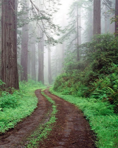
The lower part of the banks of the river Nere, near Viella, is populated by riverbank vegetation which exudes the freshness of the river. The higher part is wilder, being a veritable high mountain area, where Lake Hòro, nestling at the foot of La Forcanada (2880 m), is breathtakingly beautiful. The river Nere flows through the centre of Viella, and its waters run into the river Garona further downstream. This river rises in the highest part of this valley, where el Tuc de la Gerbosa, el Cap de Tóro and la Forcanada seem to touch each other. There is a track leading out of the Cap dera Vila, following the course of the river Nere at the point where the river runs through Viella. A few metres of proper road are replaced by a rising forest track that leads to the N-230 major road. A few metres along this road there is a detour veering right, over the incinerator, where you take the track that leads to the mountain of La Tuca. La Tuca is a splendid vantage point overlooking the Middle Part of the Arán valley and almost all of the High Arán Valley. La Tuca, as the hiker will soon realise, was a ski resort (1800 m) until fairly recently. Sprawling meadows carpet the top of the mountain, and the site also offers a splendid view of El Aneto and La Maladeta. The road crosses the forest of Betren on the way down. The track leads straight to the village of Betren (1036 m). You take the track at the well-known Cap dera Vila, following the course of the river Nere at the point where it flows through Vielha. After a few metres of surfaced road, take the forest track up to the N-230, and a few metres further on take the track that leads to the mountain of la Tuca.